Spatial Teaching
GTF Beth Koontz discusses the potential for teaching with spatial technologies in the college classroom.
|
|
Spatial Teaching
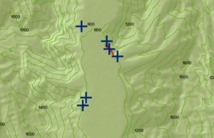
In recent years, researchers and teachers from all disciplines have begun utilizing spatial analysis tools to engage students in problem-based research and peer-to-peer construction of knowledge. GIS and GPS are excellent tools for fostering higher order thinking skills of Bloom’s taxonomy, like evaluation, synthesis, analysis, application, and long-lasting knowledge in most disciplines. People and things inhabit space, so spatial technologies are well-suited for showing spatial (and temporal) variation in characteristics, or attributes, of objects at multiple scales, from individual to population, to state, and nation levels. A GIS (Geographic Information System) incorporates data capturing hardware (computers and GPS, or Global Positioning Systems, like your cell phone), and software (ESRI’s ArcMap is the industry standard, while GRASS and MapWindow GIS are some freeware applications), based on various geographic projections and coordinate systems.
 A GIS helps researchers and teachers quickly depict large quantities of data efficiently and dynamically (see ESRI’s description of GIS). A quick click of the info button in ArcMap, for example, will show all attributes of a particular data point within the spatial context of neighboring data. Beyond depicting data, GIS analysis software allows researchers and teachers to investigate relationships between data points. For example, a researcher could ask where the statistical center of a polygon is, where the next nearest-neighbor is from one data point to another, or what areas are visible from a mountain peak. The possibilities are absolutely endless for involving students not only in data collection, but in the development of research questions and hypothesis testing through GIS-based analyses. The geographic approach (see ESRI’s description of this research method) closely mirrors the scientific method, and offers teachers a way to teach research design at all age levels.
The advantages of using GIS in teaching include getting students out of the classroom and into the field to gather data. GIS-based collaborative projects allow students to interpret and integrate new lines of data and ask new research questions after initial collection. With one set of data represented in a GIS, for example, an instructor could change the symbols and types of data that are represented, and challenge students to interpret these new maps. Data interpretation and visualization are higher-order skills that are difficult to cultivate in students (yes, even in data-driven disciplines), and the flexibility of data depiction in a GIS allows ample opportunities for students to work their interpretive muscles out. Also check out Google’s new Fusion Tables Api for more about how to collaboratively collect, analyze, and visualize your data in interesting ways.
So how do you get started using GIS and GPS in your teaching?
- First and foremost, find a research problem or an issue that can be addressed with spatial data. Situating your learning objectives for students within a real-world context will give students a chance to think critically about the data sets they are using (if gathered from other researchers), how they are going to collect their own data, and how their project articulates with extant research.
- Check out Vanderbilt Library’s resources on GIS, which include information on how to get your own copy of ESRI’s ArcMap 10.1 software and codes for training tutorials, as well as presentations on finding and using data in your GIS project.
- Leave yourself plenty of time to learn the software! ArcMap and freeware GIS programs are challenging to learn and computationally-intensive. If you plan on using GIS as part of a hands-on learning exercise in your classroom, you should plan to start learning the GIS program you will use, at least 1-2 months before hand. Many users report having to spend at least 2-4 hours outside of class time each week just learning the basics of map-making and data display in ArcMap.
- Check out the resources below for more information about how instructors have used GIS in their classrooms to guide active learning exercises. Most of these resources are available online through the Vanderbilt library.
- Last, but not least, come to the Center for Teaching’s 2013 GradSTEP workshop on Spatial Teaching to try out using GIS and GPS in your own teaching!
Resources
Drennon C. 2005. Teaching geographic information systems in a problem-based learning environment. Journal of Geography in Higher Education 29(3):385-402.
Fagin TD, and Wikle TA. 2011. The Instructor Element of GIS Instruction at US Colleges and Universities. Transactions in GIS 15(1):1-15.
Madsen LM, and Rump C. 2012. Considerations of How to Study Learning Processes when Students use GIS as an Instrument for Developing Spatial Thinking Skills. Journal of Geography in Higher Education 36(1):97-116.
McClurg PA, and Buss A. 2007. Professional development: Teachers use of GIS to enhance student learning. Journal of Geography 106(2):79-87.
Patterson TC. 2007. Google Earth as a (not just) geography education tool. Journal of Geography 106(4):145-152.
Read JM. 2010. Teaching Introductory Geographic Information Systems through Problem-based Learning and Public Scholarship. Journal of Geography in Higher Education 34(3):379-399.
Songer LC. 2010. Using Web-Based GIS in Introductory Human Geography. Journal of Geography in Higher Education 34(3):401-417.


Leave a Response